Volcano Live
volcanolive.com
Kelut Volcano | John Seach

(Kelud)
East Java, Indonesia
7.93 S, 112.31 E
summit elevation 1731 m
stratovolcano
Kelut volcano has been the location of some of Indonesia's most deadly eruptions. Kelut is located about 90 kilometers from Indonesia's second largest city of Surabaya. Typical eruptions are short and violent, and produce pyroclastic flows and lahars.
Kelut has produced repeated eruptions through the crater lake that begins by expelling the water in the lake, causing lahars, then producing Vulcanian explosions with the formation of pyroclastic flows.
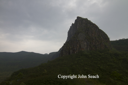
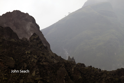
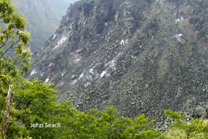
Kelut volcano photos by John Seach
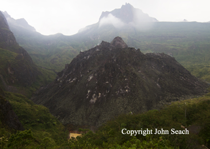
Kelut Volcano 2012. Lava dome in summit crater.
Kelut volcano
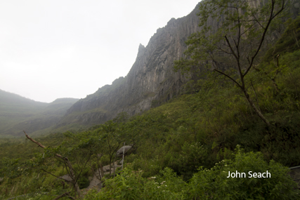
Kelut volcano
Kelut lava dome
Kelut volcano, lava dome
2014 Eruption
A major eruption occurred at Kelut volcano (Kelud), Indonesia on 13th February 2014. The eruption was heard 200 km away in Yogyakarta. Ash reached an altitude of 55,000 ft and extended 500 nautical miles WSW. A 10 km exclusion zone was placed around the volcano, and 200,000 people ordered to evacuate. Kelut volcano has a history of dangerous eruptions.
Kelut volcano was raised to level 2 alert (Waspada) on 2nd February 2014. Between 22-31 January 2014 there were 234 shallow volcanic earthquakes recorded at the volcano. Earthquakes had a focus of 2-8 km depth. Water in the crater increased by 5.5 degrees Celsius. A 2 km radius exclusion zone was placed around the crater.
2007-08 Eruption
Activity increased at Kelut volcano in August 2007.
An earthquake crisis in October 2007 was followed by formation of a lava dome. The crater lake increased in temperature, drop in pH, and change in colour from green to yellow as carbon dioxide gas escaped from the bottom of the lake. A passive eruption of lava from the crater lake occurred on 4th November 2007. Dome growth finished by April 2008, when it was 200 m high, 400 m wide. The crater lake had almost disappeared by the middle of May 2008.
1990 Eruption
An eruption began at Kelut volcano on 10th February 1990. Pyroclastic flows traveled 6 km down a valley on the E flank. The crater lake emptied during the eruption. Most of the damage and casualties were caused by heavy tephra falls. Ashfall was reported at Malang 35 km E of the volcano. The weight of the tephra caused houses to collapse, killing 32 people.
1966 Eruption
More than 200 deaths in the 1966 eruption.
1951 Eruption
In August 1951 Kelut volcano erupted with little warning. The drainage tunnel
system of Hettinga Tromp proved to be very effective in controlling the lahar dangers. Lahars were not formed. Only the top area was scorched and covered by pyroclastics. Seven people were killed near the summit, including the two observers from the Volcanological Survey of Indonesia who were trapped an emergency tunnel at a distance of about 2 km from the crater. The tunnel system of Hettinga Tromp was destroyed by the eruption. The crater floor was lowered by 79 m from
its original level of before the 1951 eruption.
1919 Eruption
The volume of the crater lake was very large prior to the 1919 eruption. In May 1919 eruptions ejected water from the lake in seconds, forming hot lahars, and causing 5100 fatalities. A lava dome formed prior to 1919 eruption. It was composed of andesite, and was blown apart in an eruption. Lahars
from the 1919 eruption of Kelut flowed nearly 40 km west of the summit.
1901 Eruption
In 1901 ash fell at Jakarta and Serang 650 km from the volcano.
1586 Eruption
A large eruption in 1586 produced lahars which killed 10,000 people.
Further rerading
Goode, L.R., Handley, H.K., Cronin, S.J. and Abdurrachman, M., 2019. Insights into eruption dynamics from the 2014 pyroclastic deposits of Kelut volcano, Java, Indonesia, and implications for future hazards. Journal of Volcanology and Geothermal Research, 382, pp.6-23.
Hadikusumo, D., 1974. The rise and drop of Mt. Kelut crater bottom after paroxysmal eruptions. Tectonophysics, 23(4), pp.341-347.
Kelut Volcano Eruptions
2014, 2007-08, 1990, 1967, 1966, 1951, 1920, 1919, 1901, 1864, 1851, 1848, 1835, 1826, 1825, 1811, 1785, 1776, 1771, 1752, 1716, 1641, 1586, 1548, 1481, 1462, 1451, 1450, 1411, 1395, 1385, 1376, 1334, 1311, 1000